Droogte in Nederland verraadt bominslagen
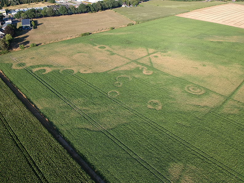
De bijzondere droogte in Nederland heeft voor diverse plaatsen in Nederland (en Europa) nieuwe inzichten opgeleverd op het gebied van landschapshistorie. Op het gebied van archeologie, maar ook voor wat betreft locaties die betrokken zijn geweest bij oorlogshandelingen. Met behulp van drones heeft ECG een dergelijke locatie in kaart weten te brengen. Op de beelden (genomen op 50 meter hoogte) is een combinatie van beide disciplines te zien: sporen van archeologie (de rechte lijnen in het landschap, afkomstig van eeuwenoude tuinencomplexen) en plaatsen waar in 1944-1945 grote aantallen vliegtuigbommen zijn neergekomen. In samenwerking met het plaatselijke gemeentearchief wordt het onderzoek op deze locatie momenteel voortgezet door middel van vooronderzoek naar bombardementsdata, bommenlasten etc. Uiteraard mèt het oog op de bijkomende archeologische waarden die in het gebied verwacht kunnen worden.